This page contains affiliate links. If you purchase through them we may earn a small commission at no extra cost to you. Learn more
Planning UK Wild Camping Routes When Paths and Trails Are Unreliable
Planning Routes When Paths Are Unreliable
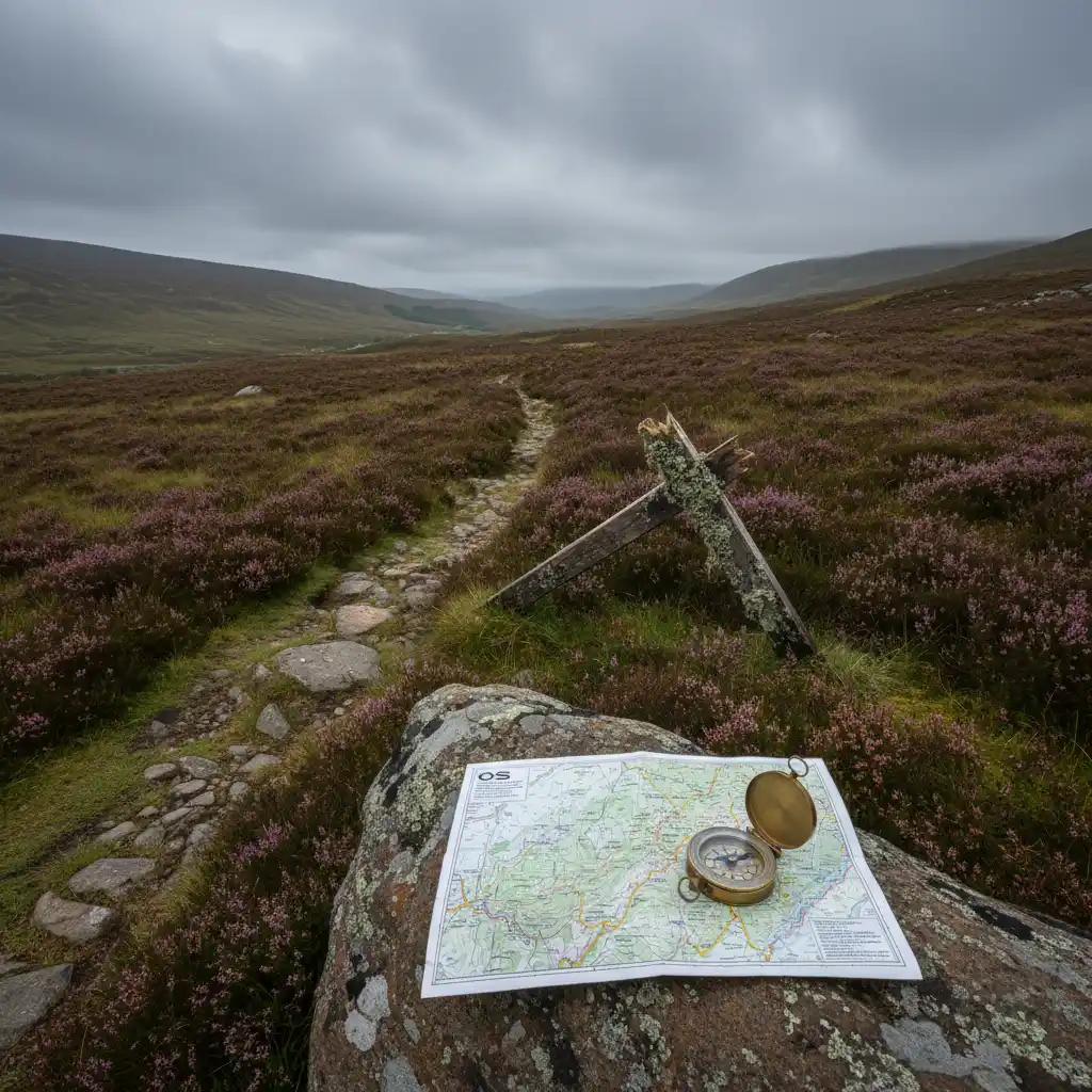
Here is the reality of UK wild camping route planning in 2026: a path marked on your OS map may not exist in any useful sense. It may be a faint line through head-high bracken, a muddy scramble where a clear track once ran, or it may end at a stream crossing where a footbridge stood until last winter's flood knocked it out.
This is not a new problem, but it is getting worse. In January 2026, Mountaineering Scotland published a survey finding that Scotland's world-class outdoor access rights are "being pushed to breaking point due to a collapse in investment in staff and paths." Ramblers Scotland surveyed frontline staff at 32 councils and both national parks. Their director Brendan Paddy put it plainly: "Today's shocking results show that we've got world-class outdoor access rights, but third-rate funding."
The implications for anyone planning a wild camping route are real and immediate. An OS map is a record of what was surveyed, not a guarantee of what you will find.
Quick Summary
- Scotland's path network is under severe funding pressure — blocked trails and broken bridges are increasingly common on mapped routes.
- OS maps can be years out of date on path conditions. Always verify with recent trip reports, the OS crowdsource layer, and local access ranger contacts.
- Plan routes with a navigation-first mindset: identify alternative lines, mark escape routes, and treat every path as provisional until confirmed current.
Why OS Maps Can't Keep Up
Ordnance Survey produces excellent maps. The Explorer 1:25,000 series remains the definitive tool for UK route planning, and nothing replaces it for reading terrain. But it is a national mapping programme with a rolling update cycle, not a real-time path condition service.
Rights of way in England and Wales are recorded on definitive maps held by county councils — documents that are often decades out of date and routinely contested. In Scotland, the Core Paths network is designated by local authorities under the Land Reform (Scotland) Act 2003, but designation and maintenance are separate obligations. A path can be legally designated, marked on OS, and still be completely impassable.
What maps cannot tell you:
- Whether a footbridge is intact
- Whether a section of path has eroded into a loose scree slope
- Whether a low-lying section is flooded or waterlogged for months at a time
- Whether a kissing gate has been welded shut or a stile removed
- Whether a section through forestry has been blocked by windblown timber
The OS Maps app does include a crowdsource layer — a user-reported overlay where walkers flag degraded, blocked, or missing sections. It is imperfect and patchy in coverage, but for popular routes it is the fastest way to see recent on-the-ground feedback without reading through forums.
Do not assume a bridge is still there. Bridge failures after flooding are common across Highland Scotland, and many are not repaired quickly. Walk Highlands trip reports from the last 12 months are the fastest way to check. If a report mentions "bridge washed out" and nothing more recent contradicts it, plan your crossing or plan a different route.
How to Verify a Route Before You Leave
Verification takes 20 minutes and can save a ruined trip — or worse.
Step 1 — Trip reports first. Walk Highlands (walkhighlands.co.uk) has user-submitted reports for thousands of Scottish routes, often with photos. Filter by recent date. Reports from the last three to six months are your most useful source on current conditions. Look specifically for mentions of bridges, path quality, and any diversions.
Step 2 — OS Maps crowdsource layer. Download the OS Maps app if you haven't already. Toggle the crowdsource overlay and check your planned route for any flagged sections. Red or amber marks on a path you're relying on deserve investigation before you commit.
Step 3 — Local hillwalking clubs. Clubs affiliated with the British Mountaineering Council or Mountaineering Scotland regularly post recent conditions reports and often know about local infrastructure problems that haven't made it to public forums. Their websites or Facebook groups are worth five minutes of searching for your area.
Step 4 — Access rangers and estate contacts. Every Scottish local authority has an access ranger function, and many estates have their own contacts. If you're planning a route that relies on a specific bridge or managed path, a quick email to the relevant ranger can confirm current status. This sounds formal; in practice they're usually helpful and responsive.
Step 5 — The estate or land manager website. For popular Highland areas — particularly those with deer stalking — estates increasingly post path and access notices. Glenfeshie, Knoydart Foundation, and several others maintain notice boards or website updates on access conditions. Check before you go.
For Scottish mountain routes, bookmark the Mountaineering Scotland news page. They publish path and access updates, including temporary closures and deteriorating infrastructure. Their January 2026 survey named the funding collapse explicitly — this is a live issue, not historical context.
Building Alternative Lines Into Your Plan
A navigation-first approach means you never have a single planned route — you have a primary line and contingency options.
Before any wild camping trip, mark on your map:
An escape route from every third of the journey. If the middle section becomes impassable, where does it lead you? Can you loop back, exit east, or reach a road or bothy from there?
Alternative crossings for every watercourse. If your mapped footbridge is gone, where is the nearest ford? Check contours and OS blue symbols upstream and downstream. A narrowing in the contours alongside a stream often indicates shallower water. Have a plan B for every significant crossing.
Navigation anchors that don't depend on paths. Walls, ridgelines, stream junctions, and summit cairns exist whether the path does or not. Build these into your waypoints. If the path vanishes into bog, you can still navigate to your destination using terrain features alone.
This is standard practice for remote Highland routes — Cape Wrath Trail completionists expect to lose the path repeatedly and navigate by compass across open moorland. But the same thinking applies on any route where path maintenance cannot be assumed.
The Scotland Context
Scotland's access rights under the Land Reform (Scotland) Act 2003 are genuine and broad. You have the legal right to be on unenclosed land regardless of what paths exist or whether they're maintained. This is a meaningful freedom.
But the collapse in path maintenance funding means the legal right and the practical reality are diverging. In 2026, Ramblers Scotland flagged blocked trails and broken bridges as active consequences of the funding gap — not theoretical risks. The survey covered all 32 councils and both national parks. The picture is systemic, not localised.
Legal access does not mean safe or navigable terrain. When you exercise access rights off a maintained path, you are doing so on your own navigation and terrain assessment, not on the assumption that someone has made the ground walkable for you.
For anyone planning routes in the Northwest Highlands, Knoydart, or other remote areas with minimal path infrastructure, this means navigation skills — compass work, contour reading, pacing and timing — are not optional extras. They are the baseline.
The Northwest Highlands, Fisherfield, and Knoydart have some of the most remote terrain in the UK with very long mountain rescue response times. If your route depends entirely on a mapped path and that path is gone, you need to be able to navigate without it. This is not a competency to develop mid-route.
A Route-Planning Checklist
Use this before every multi-day wild camping trip:
- Trip reports — Read at least two recent reports for your specific route; note any path or infrastructure issues mentioned
- OS crowdsource — Check the overlay for your primary line and any alternative crossings
- Bridge check — Identify every significant watercourse crossing; confirm each one has recent positive reports or plan a ford alternative
- Escape routes — Mark bail-out options at the beginning, middle, and end of your route on your paper map
- Waypoints by terrain — Ensure your key waypoints are identifiable features (ridgelines, summits, stream junctions), not just path junctions that may be indistinct on the ground
- Navigation kit — A paper OS Explorer map, a working compass, and the skills to use both. The OS Maps app as a supplement, not a replacement
- Local contact — Know who to call in the area if you need to check conditions on the day
The path marked on your map is a starting hypothesis. The verification process above converts it into a route you can actually commit to.
Ready to gear up?
Use our kit builder to get a complete packout list tailored to your trip type, terrain, and budget — with prices and buy links.
Related reading
Beginner's Guide to Wild Camping in the UK — Getting Started
A complete step-by-step guide to wild camping for first-timers — what you need, how to find a spot, and how to have a brilliant first night outdoors.
Best Wild Camping in the Scottish Highlands — Spots and Tips
A guide to the best areas for wild camping in the Scottish Highlands — where to go, when to visit, and how to make the most of Scotland's right to roam.
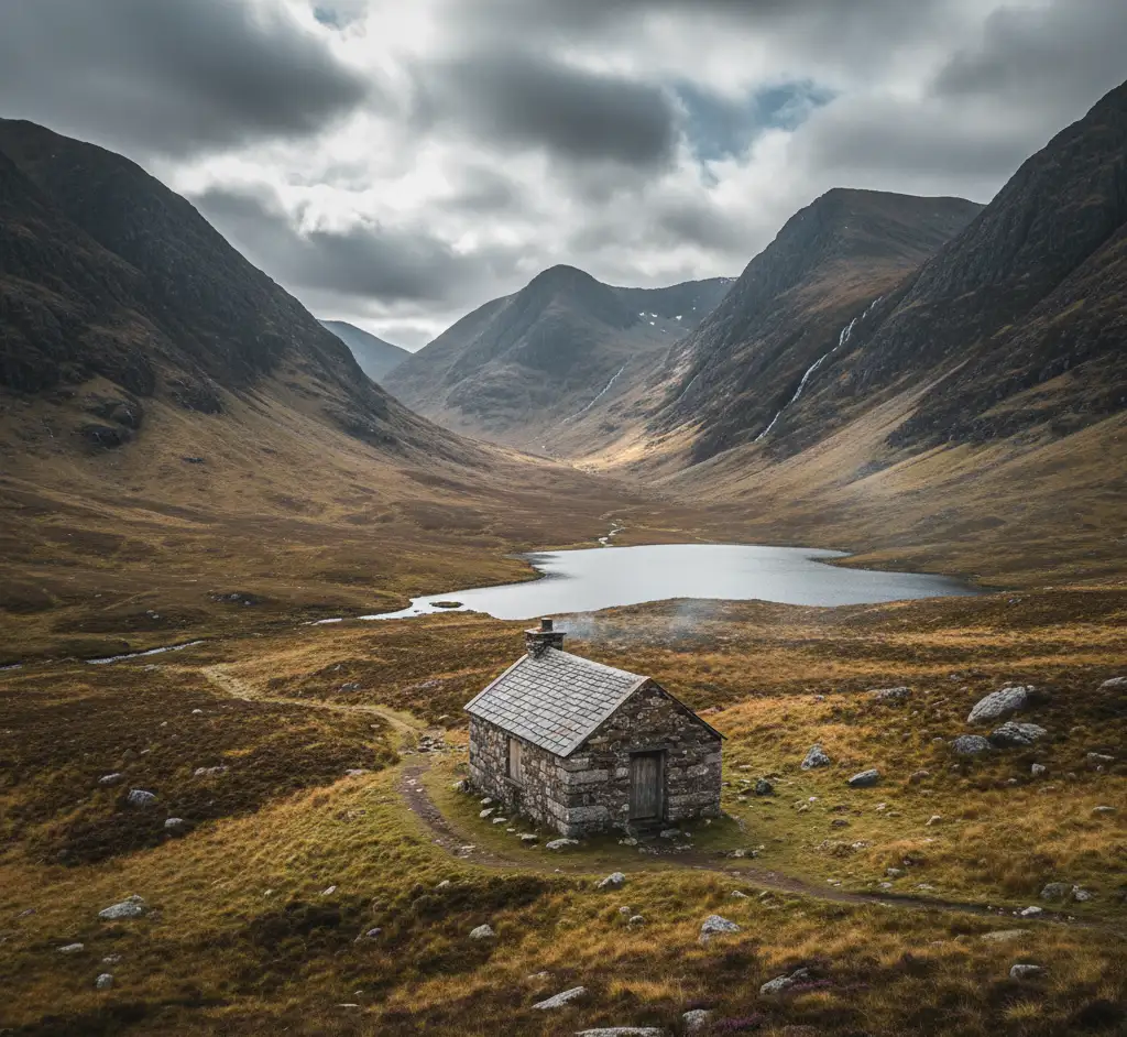
Bothies Guide — Free Mountain Shelters Across the UK
Everything you need to know about bothies in the UK — what they are, how to find them, bothy etiquette, and some of the best ones to visit.
Navigation Without GPS: Map, Compass & Natural Navigation
How to navigate with a map, compass, and natural signs when GPS fails — essential skills for UK hill walking and bushcraft.