This page contains affiliate links. If you purchase through them we may earn a small commission at no extra cost to you. Learn more
Navigation Without GPS: Map, Compass & Natural Navigation
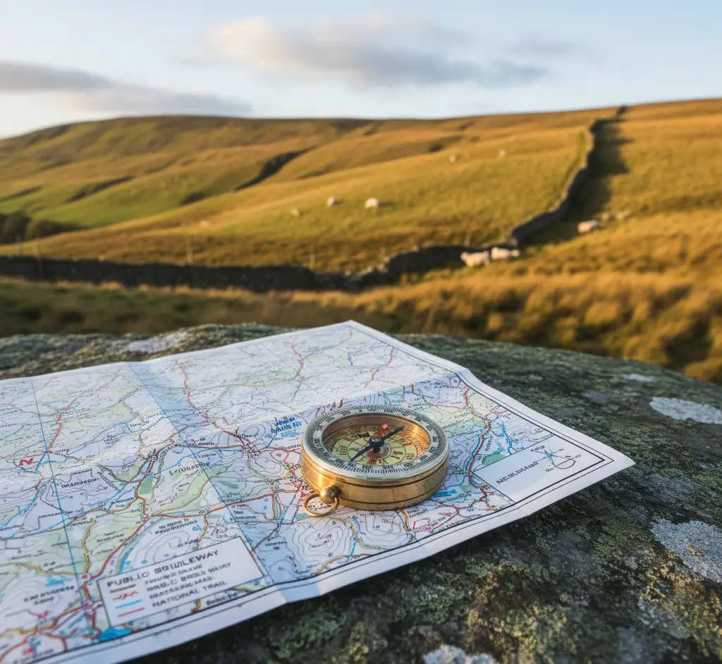
Navigation Without GPS: Map, Compass & Natural Navigation
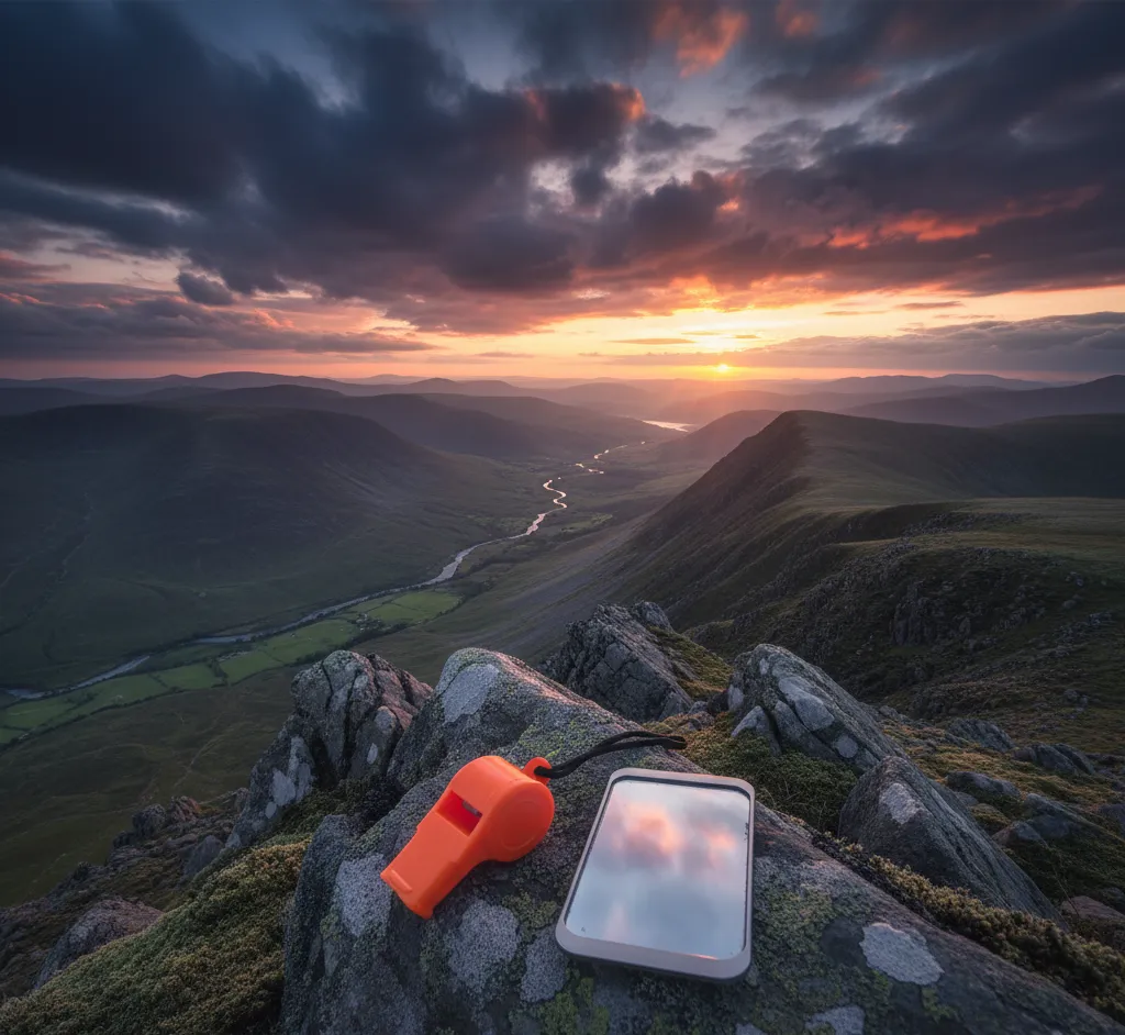
Your phone battery will die at the worst possible moment. It always does. When you're on a featureless moor in cloud, with no signal, no landmarks, and fading light, a map and compass will get you home. GPS is a tool — map and compass is a skill. One needs batteries, the other doesn't.
The Map: Your Most Important Piece of Kit
Ordnance Survey Maps
In the UK, OS maps are the gold standard. Two scales matter:
- 1:50,000 (Landranger) — good overview, each grid square = 1 km. Best for road cycling and general planning
- 1:25,000 (Explorer) — the hill walker's choice. Shows field boundaries, walls, fences, and individual buildings. Each grid square = 1 km. This is the one you want
Reading Contour Lines
Contour lines are the key to reading terrain from a flat map.
- Close together = steep ground
- Far apart = gentle slopes or flat ground
- Concentric rings = hilltop (or depression — check for the tiny ticks that indicate lower ground)
- V-shapes pointing uphill = valleys or stream gullies
- V-shapes pointing downhill = ridges or spurs
Once you can "see" the landscape in the contour lines, you can navigate in poor visibility by matching what you feel underfoot with what the map tells you.
Grid References
Every point in the UK has a unique grid reference. Learning to give and take a six-figure grid reference is essential.
How to give a six-figure grid reference:
- Read along the bottom of the map (eastings) — find the grid line to the LEFT of your position
- Estimate tenths across the square
- Read up the side of the map (northings) — find the grid line BELOW your position
- Estimate tenths up the square
- Combine: three easting digits, then three northing digits
Memory aid: "Along the corridor, up the stairs" — eastings first, then northings.
A six-figure grid reference identifies a 100m x 100m square — accurate enough for mountain rescue to find you.
The Compass: Your Direction Finder
You don't need an expensive compass. A basic Silva or Suunto baseplate compass (£15–£30) does everything you need.
Setting a Bearing from the Map
This is the core navigation skill. It lets you walk in a precise direction even when you can't see any landmarks.
- Place the compass on the map with the edge connecting your current position to your destination
- Turn the compass housing until the orienting lines align with the map's grid lines (making sure the orienting arrow points to map north)
- Remove the compass from the map
- Hold the compass flat in front of you
- Turn your whole body until the magnetic needle sits inside the orienting arrow (red in the shed)
- The direction-of-travel arrow now points to your destination
- Walk that way
Magnetic Declination
In the UK, magnetic north and grid north are very close (currently within about 1–2°). For most walking navigation, you can ignore the difference. If you're navigating precisely over long distances, check the declination printed on your OS map.
"Red in the shed" — when the red (north) end of the magnetic needle sits inside the red orienting arrow on the housing, your direction-of-travel arrow is pointing the right way. Reverse this and you'll walk the exact opposite direction. It's the most common compass mistake.
Walking on a Bearing
In poor visibility, walking on a bearing requires technique:
- Pick a feature in line with your bearing — a rock, tussock, anything — and walk to it
- Stop. Recheck the bearing. Pick the next feature
- Repeat
- If you can't see any features (thick cloud/darkness), use a walking partner ahead of you as a marker
- Count paces to measure distance (see below)
Pacing and Timing
Knowing how far you've walked is as important as knowing your direction.
Pacing: Count every time your left (or right) foot hits the ground. On flat ground, most people take about 60–70 double paces per 100 metres. On steep, rough ground, it'll be more. Calibrate your own pace count on a measured distance.
Timing: Naismith's Rule gives a rough estimate — allow 5 km per hour on flat ground, plus 10 minutes for every 100 metres of ascent. It's not precise, but it tells you roughly when you should arrive at your next feature.
Navigation Techniques
Handrailing
Follow a linear feature — a wall, fence, stream, forest edge — that runs in your direction of travel. You don't need a bearing if you can follow a handrail to your destination or to a known point.
Aiming Off
If you're navigating to a point on a linear feature (say, a bridge on a river), deliberately aim to one side. When you hit the river, you know which way to turn. If you aimed dead-on and missed, you wouldn't know if the bridge was left or right.
Attack Points
Navigate to a large, easy-to-find feature near your destination (an attack point), then navigate precisely from there to your target. It's easier to find a big lake and then walk 300 metres south-east to a bothy than to navigate directly to a small building from 5 km away.
Catching Features
Identify features beyond your destination that tell you you've gone too far — a road, a river, a wall. If you hit your catching feature, you've overshot and need to turn back.
Natural Navigation
When you have neither map nor compass (or as a supplement to them):
The Sun
- Rises roughly in the east, sets roughly in the west
- At solar noon (about 1 PM BST in summer), the sun is due south
- Point the hour hand of an analogue watch at the sun; south is roughly halfway between the hour hand and 12 o'clock
The Stars
- Polaris (the North Star) sits almost directly above true north
- Find it by extending the "pointer stars" of the Plough (Ursa Major) five times their separation distance
Trees and Plants
- Growth is often thicker on the southern side (more sunlight) — but this is unreliable in woodland
- Moss grows on the damp side — which in the UK is often the north side, but wind exposure matters more
- Use these as very rough indicators only, never for precise navigation
Wind
- Prevailing wind in the UK is from the south-west
- Trees exposed to wind lean away from it
- Useful as a rough direction indicator if you know the current wind direction
Natural navigation gives you rough direction only. It's fascinating and worth learning, but never rely on it when precise navigation matters — especially in poor visibility on mountains. Map and compass are your primary tools.
When GPS Fails: A Checklist
If you're used to GPS and it dies, don't panic:
- Stop. Don't keep walking in what you think is the right direction
- Get the map out. Orient it to the terrain — match features around you to features on the map
- Fix your position. Use visible landmarks and take bearings back to them (resection) to find where you are
- Plan your route to the nearest safe destination. Use bearings, handrails, and attack points
- Navigate carefully. Check off features as you pass them (tick-off navigation)
- If in doubt, go down — descending to a valley usually leads to a path, road, or settlement
Practice Makes Perfect
- Buy a 1:25,000 OS map of your local area
- Walk routes you know and practise taking bearings and grid references
- Navigate to specific grid references in a local park
- Try navigating short distances with the map and compass only — no phone
- Join an orienteering club — the best navigation practice available
- Progress to navigating in poor visibility once your fair-weather skills are solid
Recommended Navigation Kit
Good navigation gear doesn't need to be expensive. A quality compass and the right OS map are all you need.
Silva Ranger S Compass
Amazon UK1:25k and 1:50k
Adjustable
Yes — bezel markings
Pros
- +DryFlex grip for cold hands
- +Luminous markings for night navigation
- +Adjustable declination
Cons
- −Slightly heavier than basic models
The compass most UK mountain leaders carry. Reliable, precise, and built to last a lifetime.
View dealAffiliate link — we may earn a small commission at no extra cost to you
Ordnance Survey Explorer 1:25,000 Map
Amazon UK1:25,000
Area-specific
Paper (Active version is waterproof)
Pros
- +Gold standard UK mapping
- +Shows field boundaries, walls, and individual buildings
- +Widely available for all UK areas
Cons
- −Paper version needs a map case in rain
Non-negotiable kit for UK hill walking. The Active (waterproof) version is worth the extra few quid.
View dealAffiliate link — we may earn a small commission at no extra cost to you
Silva Map Case A4
Amazon UKFits A4 folded map
Clear PVC
Velcro and cord
Pros
- +Keeps your map dry in any weather
- +Clear window for reading without opening
- +Neck cord included
Cons
- −Can be fiddly to refold map inside
A simple, cheap way to protect your map. Essential if you're using the paper OS map rather than the Active version.
View dealAffiliate link — we may earn a small commission at no extra cost to you
Map and compass navigation is one of those skills that feels difficult at first and then suddenly clicks. Once it clicks, you'll wonder what the fuss was about — and you'll never be dependent on a charged battery again.
Ready to gear up?
Use our kit builder to get a complete packout list tailored to your trip type, terrain, and budget — with prices and buy links.
Related reading
Bushcraft & Survival Skills: The Complete UK Guide
A practical guide to bushcraft and survival skills for UK conditions — from fire-starting and shelter-building to navigation and wild food.
Night Hiking: A Practical Safety Guide for UK Walkers
How to hike safely at night in the UK — head torch selection, route planning, navigation in the dark, and essential safety advice.
Reading Weather Signs: A Complete UK Outdoor Guide
How to read clouds, wind, and pressure changes to predict UK weather — practical skills for hill walkers and wild campers.
Emergency Signalling: How to Get Rescued in the UK
How to signal for help in a UK outdoor emergency — whistle blasts, mirror signals, phone tips, and how mountain rescue works.